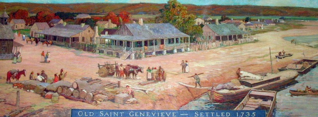
Old Ste Genevieve was established on the floodplain of the Mississippi, in 1735 or 1750 (depending on your source.) Due to massive flooding, especially in 1785, the town gradually moved to its present location on slightly higher ground, farther from the River. This mural in the Missouri State Capitol building, brought to you thanks to wikipedia, depicts the old town, which is now mostly under the Mississippi.
The “new” Ste. Genevieve is an architectural historians dream, with buildings of all eras, from 1785 on. We were mostly interested in the unique French Creole buildings — the vertical log structures, either “poteaux en terre” of which there are only five in the United States, three of them in Ste Genevieve, or “poteaux sur solle”. We were also interested in any building that was in existance before 1827, the year Henry Dodge moved to the Lead Region. A great help were the signs on many of the buildings, small, unobtrusive labels that identified the name of the building (usually the builder) and the year of construction. We had fun looking at a building and trying to guess it’s year — we were usually wrong.
For more information about Ste Genevieve see the sources section or go to http://en.wikipedia.org/wiki/Ste._Genevieve,_Missouri (I know it’s Wikipedia, but it seems pretty accurate and its a fairly succint summary) or to http://www.ste-genevieve.com/ which gives the history of some of the major houses as well as contemporary information if you are planning a visit (you should!) or for a more comprehensive view, excerpts from a photo book at http://books.google.com/books?id=vtN4OPK878QC&lpg=PP1&ots=9mDrqDmMk-&dq=ste%20genevieve%20mo&pg=PA14#v=onepage&q&f=false .
